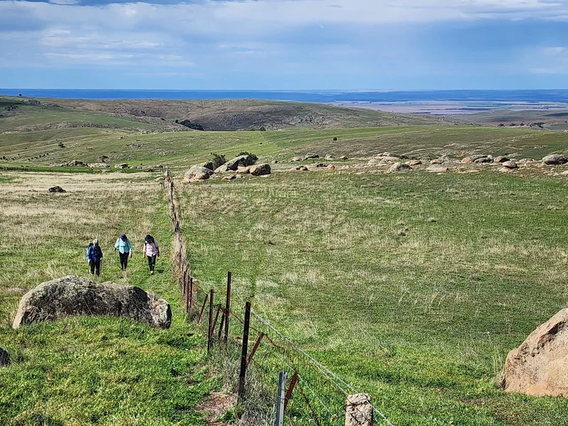
Lavender Federation Trail, TUNGKILLO LOOP TRAIL CLOSURE, From 29 June 26 to mid-2028

Tungkillo Loop Trail Closure

“Lavender Federation Trail, TUNGKILLO LOOP TRAIL CLOSURE, From 29 June 26 to mid-2028” Due to the imminent start of construction of Tilt Renewables Palmer Wind Farm (40 turbines, 220m high) the South East leg of the Tungkillo Loop Trail will be de-marked and closed on 29 June 26 until the completion of construction in mid-2028. …

Read More

Mount Horrocks Section OPENING AT END OF APRIL – ALTERNATE ROUTE STILL IN PLACE

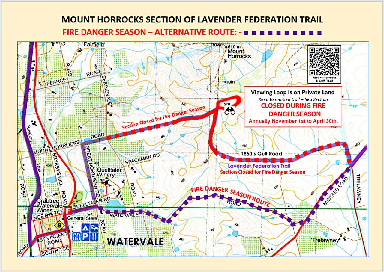
Mount Horrocks Trail Closed During Fire Season - Town Map

Please note that the whole of the Lavender Federation Trail (LFT) isCLOSED ON TOTAL FIRE BAN DAYS.The Fire Danger Season goes from 1st Nov 2025 to 30th April 2026 (Sometimes extended). Some of the notes below are also suitable for the whole trail. Bravo to Watervale’s David Spackman, who is a proud South Australian Recreation …

Read More

SUCCESSFUL WALKINGSA WALKFEST FOR SARTI IN Apr 2026

SARTI at Walkfest 2026

What a great day at the Main Oval, Belair National Park, for Board members of the South Australian Recreation Trails Inc, as we enjoyed the day talking to the attendees at the WalkingSA Walkfest,Held on Sunday the 6th April 2026 we were able to help lots of people with information,maps brochures and fliers for the …

Read More

WALKFEST – Incorporating the Hiking EXPO – Sun 6 Apr 2025

Walkfest 2024 - Sun 14th April 2024

Come along to Main Oval, Belair National Park, enjoy the day walking and talking,9am to 1:00pm on Sun 6th April 2025. Visit the SARTI Stand – talk to us about the Lavender Trails Discover walking and hiking opportunities at the WalkFest in Belair National Park. We’re bringing walking to all people and all communities with …

Read More

WALKING Trail Closure On Map 4 – Eudunda to Hampden (Rail Line) Late Dec 2024 To Early Jan 2025

TRAIL WARNING

The route of the Lavender Federation Trail between Eudunda and Hapden is getting a long awaited development to create a section of ‘Rail Trail’ through the once busy rail corridor. Contractors for the Regional Council of Goyder will be working from Late December 2024 until Early January 2025 (about 8 weeks) to create a surface …

Read More

Trail CAUTION Map 1 – Federation Ultra Trail 2024 – Monarto To Murray Bridge – Sunday August 11th 2024

TRAIL WARNING

Please be aware that this event is on: Sunday August 11th 2024 will see the 7th running of the Federation Ultra Trail Ultra 54km – Mid 26km – Short 10km – Zoo 5km – Relay Teams Entries close Friday 2nd August 2024 20:00pm The course traverses or loops from the southern end of the Lavender/Federation …

Read More

Mount Horrocks Section Re-Opens For 2024-2025 Walking Season

Mount Horrocks Trail Closed During Fire Season - Town Map

You may now enjoy the mount horrocks lookout again as fire season is not active. Bravo to Watervale’s David Spackman, who is a proud South Australian Recreation Trails Inc (SARTI) Board member and land owner along the LFT for working with other members of the SARTI Board to develop an alternative route for the LFT …

Read More

Trail Change On Map 6 – At Spring Gully Conservation Park New Area Map

TRAIL WARNING

The route of the Lavender Federation Trail between the Reisling Trail and Spring Gully Conservation Park has been amended. The cycling route, shown as a dotted blue line will follow Trevarrick and Saw Mill Roads to the Ridgetop Track, the original walking trail route as shown on Map 6 Manoora to Clare.  The new walking …

Read More

WALKFEST – Incorporating the Hiking EXPO – Sun 14 Apr 2024

Walkfest 2024 - Sun 14th April 2024

Come along to Main Oval, Belair National Park, enjoy the day walking and talking,9am to 1:00pm on Sun 14th April 2024.Discover walking and hiking opportunities at the WalkFest in Belair National Park. We’re bringing walking to all people and all communities with a range of guided walks and hikes and an expo of walking clubs …

Read More

Mount Horrocks Section CLOSED During Fire Season – USE ALTERNATE ROUTE

Mount Horrocks Trail Closed During Fire Season - Town Map

Please note that the whole of the Lavender Federation Trail (LFT) isCLOSED ON TOTAL FIRE BAN DAYS. Bravo to Watervale’s David Spackman, who is a proud South Australian Recreation Trails Inc (SARTI) Board member and land owner along the LFT for working with other members of the SARTI Board to develop an alternative route for …

Read More

Trail Change – TRURO – South of the Sturt Hwy – Map 3

TRAIL WARNING

South of the Sturt Hwy where the trail loops through the Munchinberg property and Truro Creek Gorge the trail has been moved ~100m South of the Highway and a new stile added to the inner fence, and the trail realigned and re-marked. Please comply with the bio-security and No Dogs signs at the property entry …

Read More