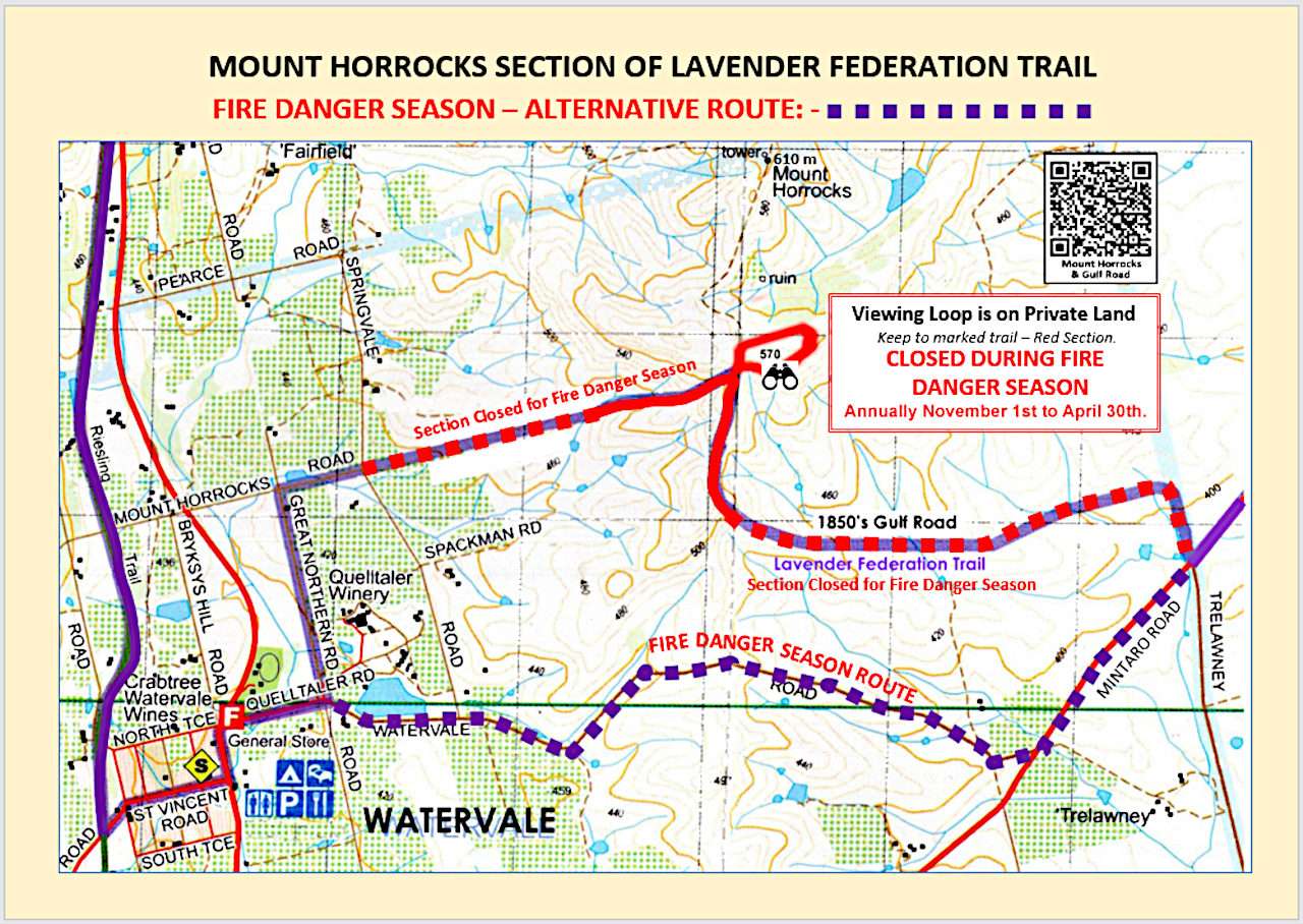
Mount Horrocks Section CLOSED During Fire Season – USE ALTERNATE ROUTE

Mount Horrocks Trail Closed During Fire Season - Town Map

Please note that the whole of the Lavender Federation Trail (LFT) isCLOSED ON TOTAL FIRE BAN DAYS. Bravo to Watervale’s David Spackman, who is a proud South Australian Recreation Trails Inc (SARTI) Board member and land owner along the LFT for working with other members of the SARTI Board to develop an alternative route for …
Read More

Trail Change – TRURO – South of the Sturt Hwy – Map 3

TRAIL WARNING

South of the Sturt Hwy where the trail loops through the Munchinberg property and Truro Creek Gorge the trail has been moved ~100m South of the Highway and a new stile added to the inner fence, and the trail realigned and re-marked. Please comply with the bio-security and No Dogs signs at the property entry …

Read More

Trail Change – At Spring Gully Conservation Park – Map 6

TRAIL WARNING

At Spring Gully Conservation Park in the Clare Valley the Lavender Federation Trail’s Eastern access point to the park has been moved from Sawmill Rd. The LFT now follows the Clare Valley Wine and Wilderness Trail (CVWWT) from/to the Park through Jeanneret Wines property and rejoins the old route on Trevarrick Rd near Skillogalee Wines …

Read More